Brigadier-General William Thompson
In Carlisle’s Old Graveyard at the corner of East South and South Bedford Streets is located an eight foot Celtic cross commemorating the burial place of Brigadier-General William Thompson.


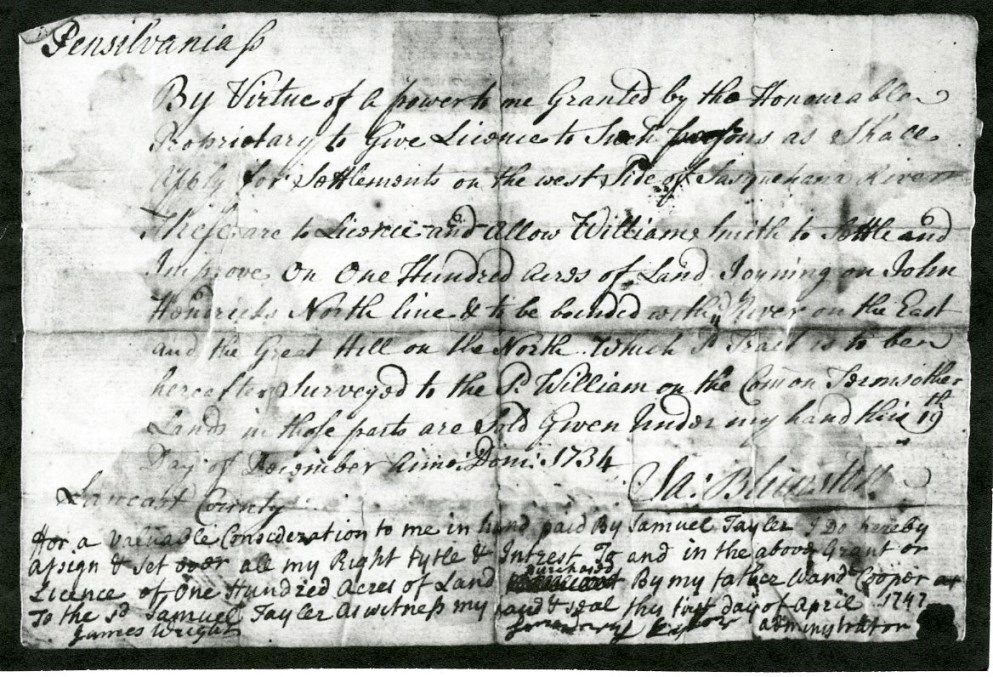
Top: Blunston License to William Smith (L4003.003.03g);
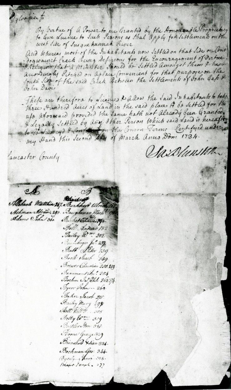
Bottom: Authorization of Samuel Blunston to grant settlements on the West side of the Susquehanna River (L4003.003.03g).
By the early 1730s the proprietaries (Thomas, John, and Richard Penn) had decided to expand the colony’s western border across the Susquehanna River as far as the present day Kittochtinny Mountains. At the same time period, a border dispute was brewing with Maryland over lands located on Pennsylvania’s southern border that would become York and Adams counties. Thomas Cresap, a Maryland agent, was using brutal tactics to keep Pennsylvania settlers off the southern lands.1 As a result, Samuel Blunston, a surveyor from Lancaster County, was commissioned to explore and map the territory that would become Northern York, Cumberland and Franklin Counties. During 1732 and 1733, he made several trips noting minor topographical features in order to help future settlers locate the land they had purchased. The features were very generic: dry spring run, limestone run, beaver dam, duck pond, barren hill, great hill, blew hill, deer lick, pine lick, big meadow and Indian path. Also, there were about forty settlers mentioned who had already been living in the valley both legally and illegally. The land offices in Philadelphia and Lancaster were issuing a few deeds in anticipation to land that had not been officially purchased from the Native Indians.2 The tracts were usually located in a neighborhood style setting with a source of water close by (springs and creeks); his thinking was much like a modern day real estate developer. As a result, large tracts of land remained uncommitted and were available for future settlement. Blunston developed a pre-warrant system, and between 1734 and 1736, he wrote two hundred and eighty-four licenses enabling future settlers to apply for a warrant. An official treaty would be signed with the Six Nations tribes on October 1, 1736. Also, as a result of Blunston’s surveying the southern border, an agreement would be settled with Maryland creating the future Mason-Dixon Line.3
In 1731, a unique section of land (7,551 acres) in future Cumberland County was set-aside for the Native Indians in case they wanted to return to the valley. It was named Pexton Manor and Lowther Manor, and Tobias Hendricks was permitted to settle in the center of this tract in order to keep any squatters from settling. The present day borders encompass: the Susquehanna River, Yellow Breeches Creek, Conodoguient Creek and the Peace Church Road. The area remained unsettled from 1731 to 1767.4
Samuel Blunston had an interesting background. He was born in Chester County in 1689, the son of John Blunston. On October 27, 1682, John, another Quaker, had immigrated from Derbyshire, England on the ship Welcome along with William Penn. In 1718 Samuel took as his wife Sarah Bulton. Blunston was a civic minded man and held such public offices for Lancaster County as Prothonotary, Recorder and Clerk of County, Justice of the Peace, and served in the Pennsylvania General Assembly.5 His death took place in 1745. Since the couple did not have any children, Samuel’s estate was willed to Sarah Wright, the daughter of his friend John Wright who operated the ferry at Columbia, Pennsylvania, where many settlers crossed the Susquehanna River instead of using John Harris’ ferry. 6
With the death of Blunston, the Penn’s appointed another Lancaster County resident as Deputy Surveyor, Thomas Cookson. As a result, many of Samuel’s ledgers and papers came into the possession of Cookson. Thomas was married to Mary Thompson the step-sister of General William Thompson. In 1754 Cookson died and Mary became the wife of a York County resident George Stevenson. A few years later, the Stevensons moved to Carlisle. Both were buried in Carlisle’s Old Graveyard very close to General Thompson’s lot. For the next one hundred and seventy years the two-volume license book remained in possession of Stevenson heirs and in the 1920s were given to the Pennsylvania Department of Internal Affairs.7 By 1930, the former State Librarian George Donehoo wrote his History of the Cumberland Valley and included in volume one a listing of all of the license recipients.8 Many early Lancaster County deeds referred to the Blunston License but this was the first exact listing.
In Carlisle’s Old Graveyard at the corner of East South and South Bedford Streets is located an eight foot Celtic cross commemorating the burial place of Brigadier-General William Thompson.
[1] Lenore Embick Flower, Blunston Licenses and Their Background, (Carlisle: Hamilton Library and Historical Association of Cumberland County, 1961) p. 3.
[2] William T. Swaim, Cumberland Valley Farm Tracts Licensed By Samuel Blunston, (Camp Hill: Planks Suburban Press, 1999) p. 9.
[3] Ibid., Flower, p. 13.
[4] Ibid., Swaim, p. 13.
[5] Ibid., Flower, p. 4.
[6] Ibid., Swaim, p. 22.
[7] Ibid., Flower, p. 11.
[8] George P. Donehoo, History of Cumberland Valley, volume I (Harrisburg: The Susquehanna History Association, 1930) p 269.